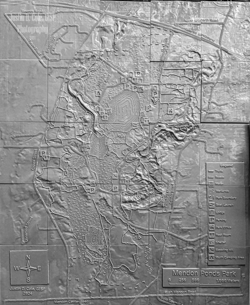
I am excited to be presenting at the ESRI User Conference in San Diego this year. I will be presenting my work on creating a 3D Printed Map. I will be presenting on Wednesday, Jul 17, 8:30 AM – 9:30 AM PDT in the Marriott Grand Ballroom Salon 10. If you would like to attend you can use this link to add it to your schedule. Also the final completed 3D print of the Mendon Ponds Park Map (photo below) will be on display in the map gallery at Panel A-17-03. I will be on hand to answer questions during the map gallery reception either at the map or at the University of Wisconsin GIS Professional Program table in the academic fair.
Click on the image of the slide below to download the presentation and try it yourself. The presentation uses some new techniques to improve the efficiency and data storage of my previous post Creating a 3D printed Trail Map for People who are Visually Impaired.