It is that time of year when students are emailing in a panic saying that they found some GIS data but it is an E00 file and how do they get that into ArcGIS Pro. Based on ESRI’s page on the Tools that are not available in ArcGIS Pro, there is no E00 import option unless you have the data interoperability extension. The E00 import tools used to be in ArcMap/ArcCatalog, but with the sunsetting of that software in the near future, I was looking for an alternative for the students. This post goes through 2 methods, one using gdal command line and the other using QGIS. The E00 that I will be using came from Cornell University Geospatial Information Repository CUGIR and are the New York State Department of Environmental Conservation Wetlands. For the software, I am using the OSGeo4W installed GDAL and QGIS.
Command Line
Utilizing the command line can be quite powerful and has access to a lot of great tools. However, not all students are familiar with the command line so this may be tricky for some. You also need to be aware of the DOS rules in path and file names.
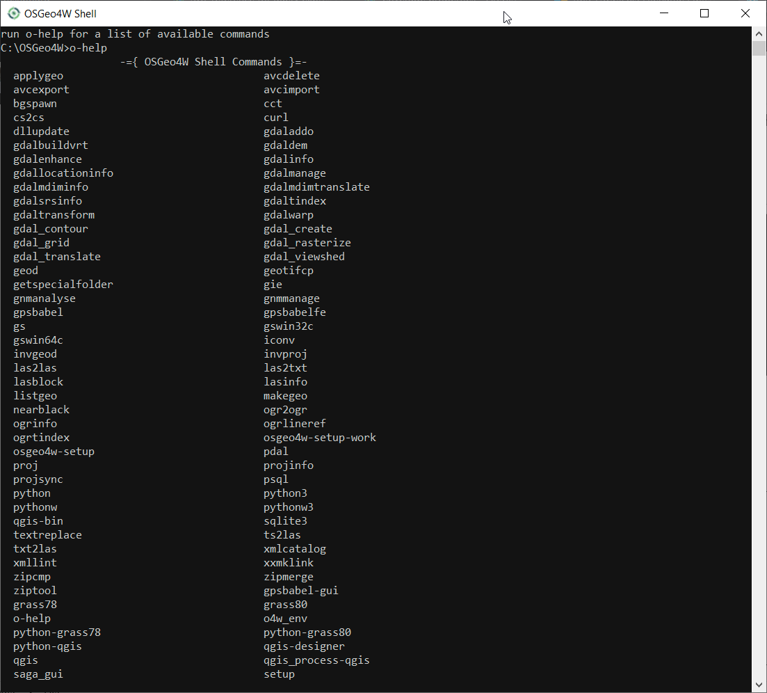
- To utilize the OSGeo4W command line go to your start menu and look for the OSGeo4WShell. This will open the Command Prompt


- From this window we can look at all of the commands available by runnin o-help. If your tools are installed properly you should see ogr2ogr which is the tool we will be using.
- I prefer to work in the folder that my data are located in. So I use cd\ and then cd folder name to go directly to the folder. Once there then you only need to use the filenames and not the full paths.
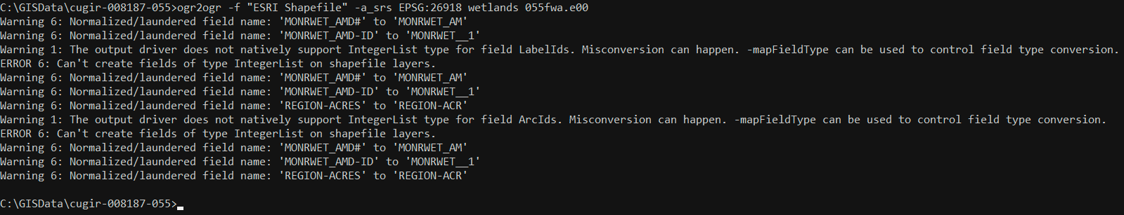
- Now enter ogr2ogr -f “ESRI Shapefile” -a_srs EPSG:26918 wetlands 055fwa.e00
- ogr2ogr is the command
- -f “ESRI Shapefile” is the output format
- -a_srs EPSG:26918 is to set your output projection. In my example I am using UTM Zone 18 North NAD1983
- Wetlands subfolder to export all of the E00 components to
- And 055fwa.e00 is the e00 file I am using in this example
- Then run the command. Note not all pieces of the E00 have data so you may see errors and warnings.
- Now you have a few shapefiles and you can add it right into your project.
QGIS Method
The QGIS method is essentially running the same tools just through the graphic interface. QGIS can read the E00 file so it is fairly easy to do.
- Open a Blank QGIS document and open the Data Source Manager

- Use the Vector Option and add the E00 to the dialog. Click Add

- When you hit Add you will get a dialog to have you pick the feature type. Since in my example I am using a polygon Wetlands, I will pick the PAL(polygon). Click Add Layers

- Then you will get a message on the coordinate system transformation if your project has a different coordinate system than the layer. So this part is up to you and your other data.
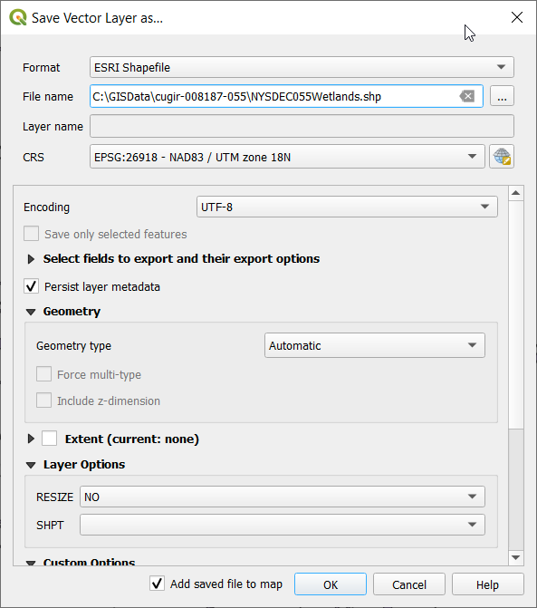
- Now your data is loaded, click on the layer in the Layers and then right click and go to Export and Save Features As

- Set the filename and path. Here you can also change the projection if you want. When you click ok it will create the shapefile. I also suggest adding it to the map to make sure it works properly.
- Now you have the shapefile and you can bring it in to what software you want to work in.

Great topic and great suggestions! Unfortunately, QGIS didn’t handle .e00 raster files…at least when I tried it.
-Dennis
LikeLike
Thanks, I was not aware of any .e00 raster files. I thought .e00 were only for coverages.
LikeLike